|
|
Cadastral Consulting, LLC
|
|
Home Contact us Who we are Classes we present Where we'll be Planning your meeting Hard to find publications Consulting Links, News, and Resources NFIP and Floodplain Management |
Links, News, and Resources for Surveyors
Links to Cadastral Sites
BLM Glossary of Surveying and Mapping terms
Return to top of pageFree Cadastral Resource Downloads
Standards and Guidelines for Cadastral Surveys Using Global Positioning System Methods, Version 1.0, May 2001 (PDF. 184 KB)
Corner Identification and Markings from the BLM 1973 Manual of Instructions (PDF, 2.2 MB)
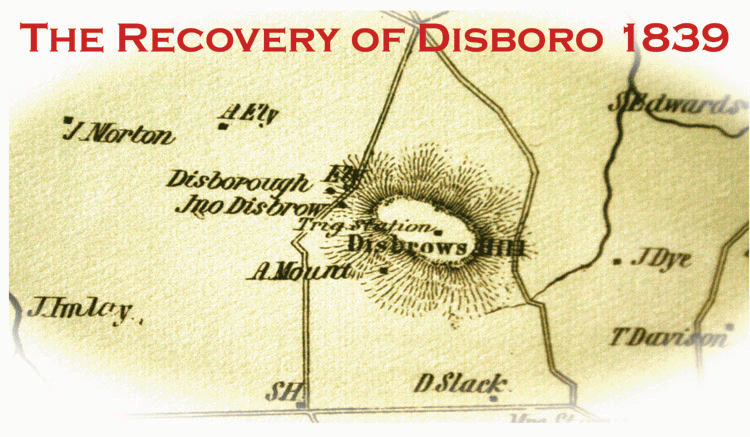
Return to top of page200th Anniversary of the US Coast and Geodetic Survey, and the Disboro Monument In the early days of our nation, there were no good maps of the coastline for navigators or the militia to use. In 1795, Congress wrote a resolution requesting that President Jefferson authorize a survey to map the New York–New Jersey coast. This map would reduce the number of shipwrecks and benefit the military in planning defense. The resolution authorizing this first coastal survey passed in 1807, but the work did not begin until 1816. A Swiss–born geodesist and methematican, Fedinand Rudolph Hassler, was named the first superinendant of this US Coastal Survey. He set up a system of triangulation to ensure that the edges of any charted location would align with the edges of adjacent areas. This new system of coordinated surveys became the first US Coast and Geodetic Survey of the domestic waters of our nation. Hassler's triangulation network stretched from New York City to Philadelphia and consisted of 18 coordinated points, a system later expanded to cover the entire country as it exists today. In 1839, a ceramic cone was buried on Disboro Hill in Millstone Township, Monmouth County, NJ, as a monumented control point in this system. Here are two articles on the story of that first survey, and of the recovery of the cone at Disboro Hill more than fifty years after it was believed to be lost. Triangulation Station Disboro 1839; Recovery 1982 (PDF, 688 KB) Uncovering the Disboro Cone (PDF, 1.7 MB) Visit our Publications page for information on the documentary video on DVD. |
page last updated September 23, 2023 |